P.S. you can help southwest weather service continual these forecast by giving a small donating.
No matter where you are around the world, you can pay SWWS by clicking on the the link Just Click Here >>>>>>>>>>>>>
Your every pound will help us keep this free weather service going
.Thank you.
To make a donation
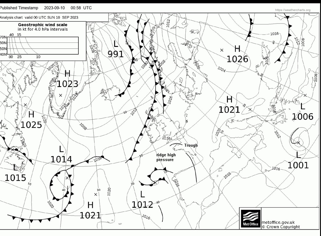
The general synopsis at Midnight complex are of High pressure Europe low Biscay with upper troughs English Channel New lows expected Rockall 1015 and south of Iceland 1004 by same time. High Lundy 1017 dissipating
Latest update at 07:30 Sunday 10th Sept: Sunday's forecast Showers at first then mostly dry but thundery shower possible later!
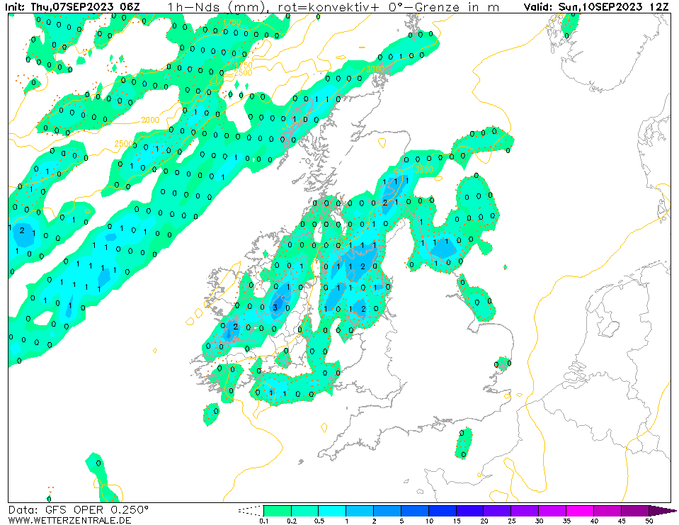
Sunday run day and the weather is going to plan and has not changed from yesterday, will still have some thunderstorms left over from Saturday night into Sunday early morning I'm expecting the thundery showers clear by 9am SWWS is then going for a dry day with hazy sunshine however a thundery low will be lurking out to SW while High pressure remains to the east a flow of warm humid southerly wind will affect Kernow a thundery upper trough could give the chance of a thundery shower later in the day *note any biker coming from Devon can expect heavy thundery downpours* Have a safe run and take Care Jeff SWWS
Latest update at 07:30 Sunday 10th Sept: Sunday's forecast Showers at first then mostly dry but thundery shower possible later!
Sunday run day and the weather is going to plan and has not changed from yesterday, will still have some thunderstorms left over from Saturday night into Sunday early morning I'm expecting the thundery showers clear by 9am SWWS is then going for a dry day with hazy sunshine however a thundery low will be lurking out to SW while High pressure remains to the east a flow of warm humid southerly wind will affect Kernow a thundery upper trough could give the chance of a thundery shower later in the day *note any biker coming from Devon can expect heavy thundery downpours* Have a safe run and take Care Jeff SWWS